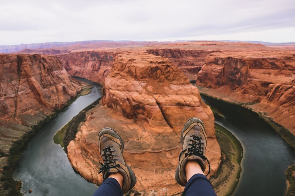
Before getting started the 20 best hiking trails in the world, let’s begin with what the hiking trails are. For those seeking an adventurous escape, hiking trails provide the perfect opportunity. With a variety of trails across the globe to choose from, there’s something for everyone. Whether you are looking for a leisurely stroll through nature or a more rigorous and challenging hike, there’s something that fits your individual needs.
From coastal routes with spectacular ocean views, to lush forests and steep mountain paths, the beauty of hiking is that each trail offers its own unique experience. Along the way, you can explore breathtaking vistas, learn about the local ecology and wildlife, and perhaps even catch a glimpse of a rare species. No matter which trail you choose, you can be sure that it will bring a lifetime of memories.
When planning your hike, be sure to take into consideration both your physical capabilities as well as the current weather conditions. Also, be sure to wear proper gear and pack all essential supplies including plenty of water and snacks to keep you going. Finally, it’s important to inform someone at home where you’re going and when you plan on returning in case of emergency.
Ready for an unforgettable journey? Grab your pack and hit one of these awe-inspiring, best hiking trails in the world!
Contents
The Inca Trail, Peru – best hiking trails in the world

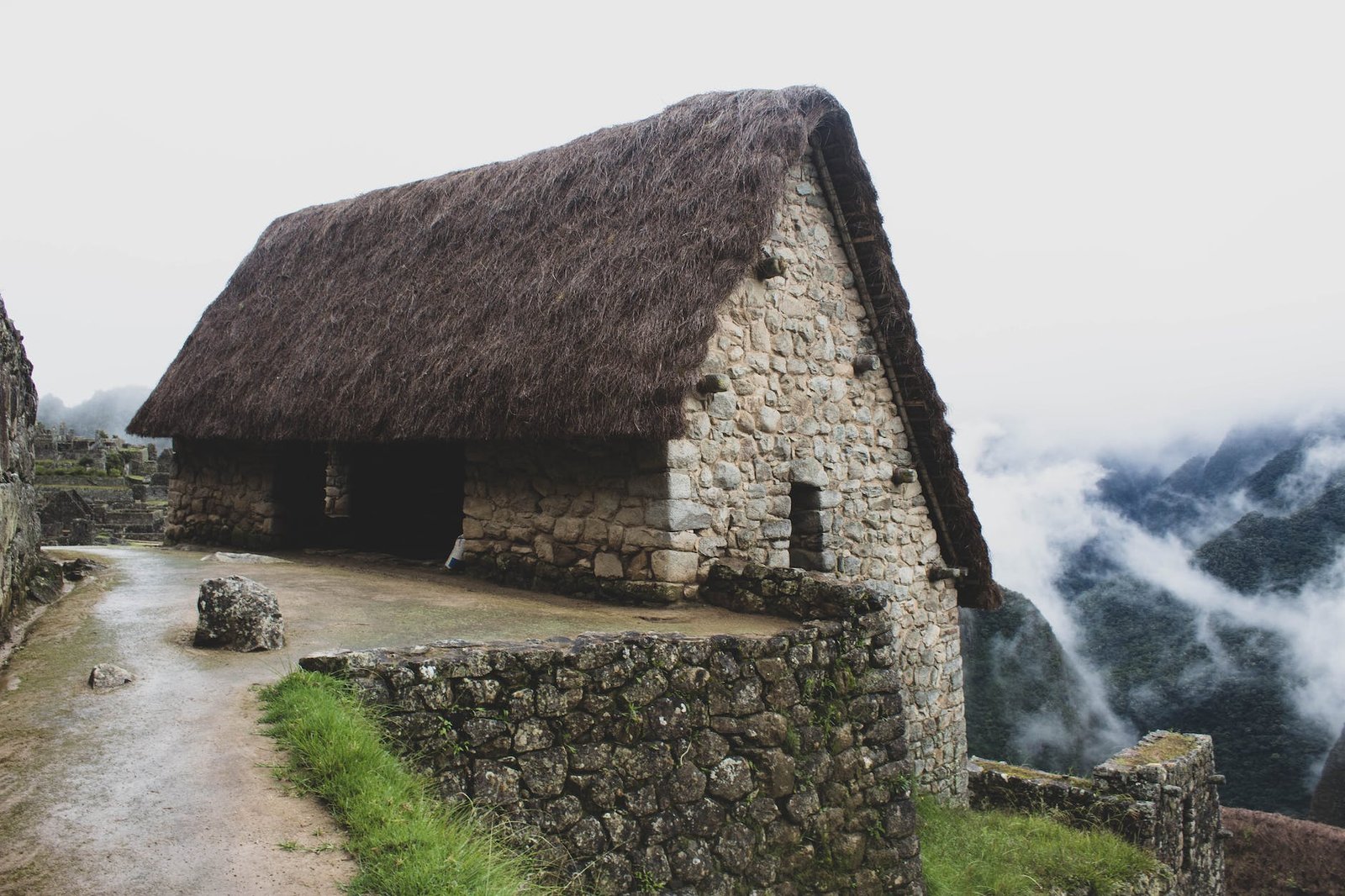
For centuries, travelers have been making their way through the Andes mountain range to experience one of the most famous trails in the world – the Inca Trail in Peru. The route follows an ancient Inca highway, once used by the ancient people to reach Machu Picchu and beyond. From alpine meadows and dense cloud forests, to lush green valleys, Inca ruins and spectacular vistas, the trek is nothing short of breathtaking.
For hikers of all levels, the four-day trail is an opportunity for discovery, as you immerse yourself in the landscape that winds around these majestic peaks and make your way towards Machu Picchu. As you climb higher up towards this renowned archeological site, your view changes from a picturesque mountain backdrop to deep canyons below; sunsets become increasingly more dramatic as the day draws closer to its close. After spending nights camping under stars, sleeping in stone cabins and cooking delicious local food over open fires – arriving at this wondrous city in Peru is truly a reward for completing this unique journey.
Along the way you’ll be immersed in breathtaking scenery as well as having access to intriguing historical sites along the trail. Not only will you witness numerous Inca ruins on route – there are also examples of pre-Inca cultures including caves with rock carvings which provide insight into these ancient civilizations who have called these mountains home long before us. For many visitors this part of their journey adds a deeper level to their travels by uncovering secrets hidden among these valleys and cliffs – and those adventurers who manage it often tell tales of discovering real gems they never knew existed before setting foot on the path itself!
One final note – no trip to South America is complete without experiencing this world-famous trek. Despite its reputation as a challenge – it’s suitable for walkers with basic fitness who can carry their own backpack and luggage (which are carried for them by support staff). All participants must remember though that not all trails may be open year round – so do check out if your preferred route is open during the time of your visit before booking!
So why not plan your very own Inca Trail adventure today? It could just be one of those trips where memories last forever – proving that adventure isn’t about getting away from civilization but rather exploring it deeply and authentically with each step you take!
Chilkoot Trail, Canada
Nestled in the lush coastal temperate rainforest of British Columbia and Alaska, Chilkoot Trail is an iconic trekking trail steeped in rich history. From 1889 to 1898, it served as a route for thousands of fortune seekers making their way through the wild frontier to join the Klondike Gold Rush. Today, this breathtaking natural area serves as a source of adventure and awe-inspiring scenery.
As one of Canada’s most famous hiking trails, Chilkoot Trail offers adventurers stunning vistas and unique opportunities for exploration. The 33-mile trail takes about three days to complete, but can be customized for longer or shorter hikes based on one’s interests and experience level. No matter how long you plan on staying, visitors should expect lots of winding terrain and rewarding panoramic views from its mountainous peaks.
When embarking on the trail, travelers must take precautions such as having enough water, food, and appropriate clothing as there are no services along the way. Furthermore, all hikers must obtain a permit from Parks Canada prior to their journey since the Chilkoot Trail falls within a protected parkland area. It’s important to bear in mind that weather conditions can vary drastically depending on the season; however if you find yourself camping along the way you’ll likely be rewarded with spectacular northern lights shows during the summer months!
One of the highlights of exploring Chilkoot Trail is discovering relics from bygone gold rush era settlements like abandoned boats and shelters. During your time on the path you’ll pass historic artifacts such as rusting cables from prospectors’ attempts to move massive pieces of equipment over ice and snow-covered terrain – something they couldn’t have possibly imagined while plotting out their next big fortune in 1898!
Whether it’s checking off your bucket list or escaping into nature for an unforgettable weekend getaway – Chilkoot Trail is guaranteed to bring memories that will last a lifetime. All who dare make this trip will experience both remarkable stories told throughout centuries past and unforgettable wilderness backdrops only found at this exceptional location in Canada.
Routeburn Track, New Zealand

Situated in the beautiful South Island of New Zealand, the Routeburn Track is one of the country’s Great Walks. With lush rainforest, crystal clear lakes and stunning alpine views, this three to four-day hike promises breathtaking vistas. It’s no wonder why so many people have made the trek over the years!
Beginning in either Glenorchy or Queenstown, you will pass through forests and cross a variety of bridges while navigating your way around Mt. Aspiring National Park. Whether you decide to tackle the entire 32-kilometer trail in one go or opt for shorter day hikes, there are plenty of unique spots to enjoy along the way. There are many glacial tarns and secluded waterfalls as well as vistas that span miles of alpine landscape. And for those seeking a challenge, you can attempt the 12 kilometer Mackenzie Basin Walk – an additional part of Routeburn Track.
Whether you’re traveling solo or with friends, the route offers something special for everyone; from first-time hikers to experienced outdoorsmen. Before heading out on any multi-day trekking trips such as Routeburn Track it’s important to plan ahead. Prepare for changes in weather conditions by bringing warm clothes, sturdy walking boots and layers which can be easily added or removed as necessary throughout the hike.
For those looking for an experience that offers both adventure and awe-inspiring scenery, look no further than Routeburn Track.
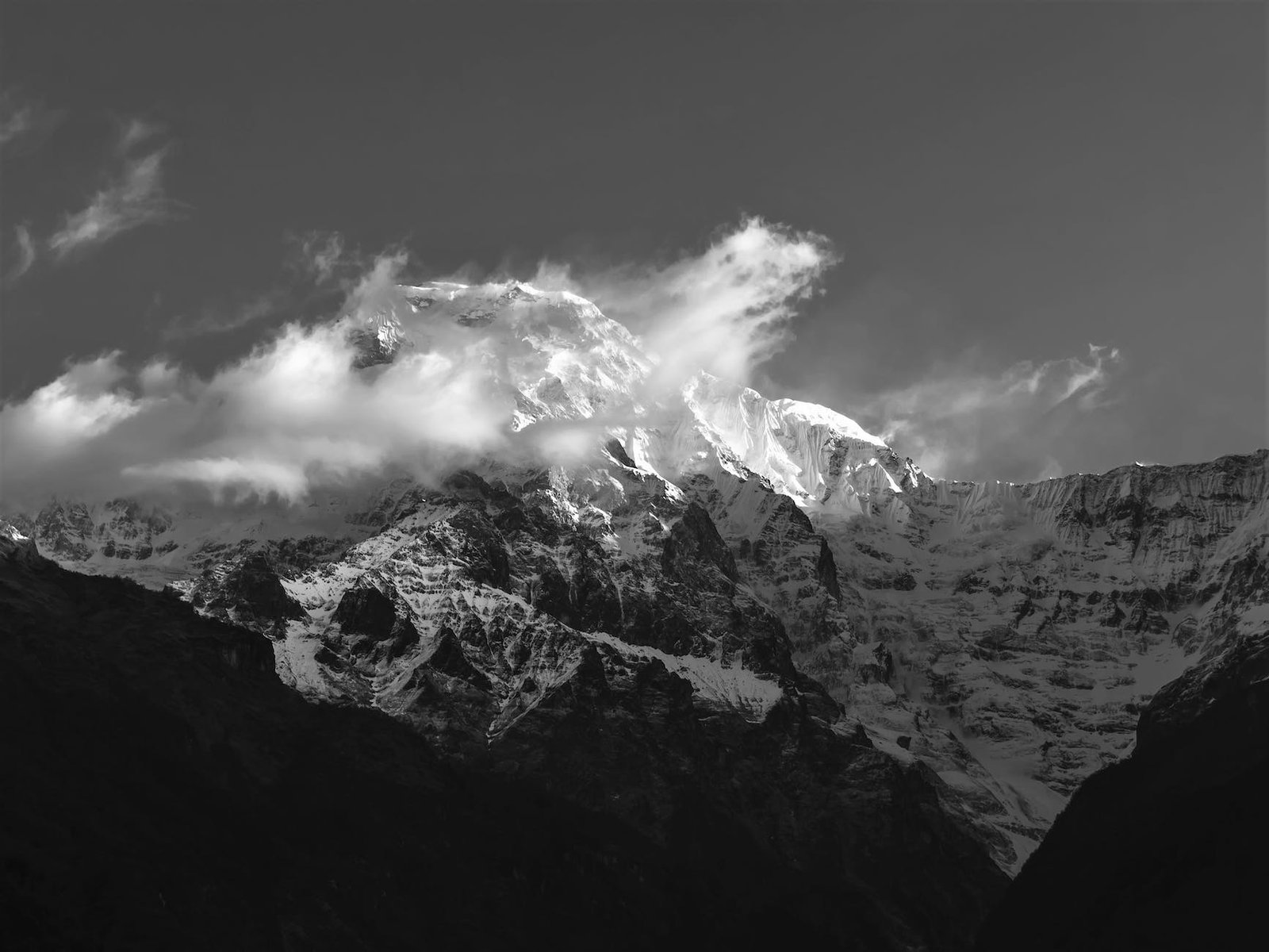
Everest Base Camp Trek, Nepal
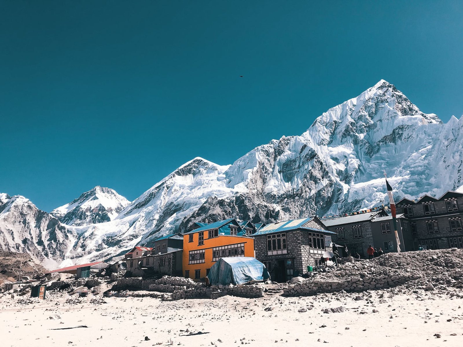
Located in the heart of Nepal, Everest Base Camp Trek is one of the most popular and breathtaking hikes in the world. Nestled between majestic snow-capped peaks, picturesque villages and lush valleys, this incredible trek will give you a once-in-a-lifetime opportunity to experience nature’s beauty. Whether you’re an avid hiker or just looking for an exciting new adventure, this trek is sure to exceed all expectations.
At an elevation of around 5,300 meters (17,500 feet), it is considered one of the highest treks on Earth. Starting in Lukla, your journey takes you through remote Sherpa villages as you make your way to Namche Bazaar and finally towards Everest Base Camp and Kalapatthar. Along the way you’ll witness stunning panoramic views of Mount Everest and other mighty Himalayan peaks like Nuptse, Lhotse and Amadalam. The entire route passes through amazing forests filled with vibrant rhododendron blossoms, quaint settlements perched along the ridges, deep gorges and glaciers with icefall tumbling down their faces.
This thrilling hike is not without its challenges though; trekkers will be subjected to harsh weather conditions including windy temperatures and occasional snowfall that may reduce visibility considerably. As such, proper preparation and equipment are essential to complete this adventure safely and successfully. We recommend joining a professional guided group if possible; they are more experienced and better equipped to handle any surprises along the trail. In addition to proper physical conditioning prior to the trek itself, proper acclimatization is key in order to minimize altitude sickness risks.
If you’re lucky enough to complete this hike, prepare yourself for some incredible moments of awe – nothing quite compares to standing amidst soaring snowcapped mountains while watching glaciers glimmer in the sun! So if you’re looking for a life-changing experience that will take your breath away literally as well as figuratively – embark on an unforgettable Everest Base Camp Trek in Nepal!
Tour du Mont Blanc, France/Switzerland/Italy

If you’re looking for an unforgettable trekking adventure, then the Tour du Mont Blanc should be on your must-do list. This 11-day hiking circuit takes adventurers through France, Switzerland and Italy along a route of around 170 km that circles the magnificent Mont Blanc mountain range in the French Alps. The trip provides an opportunity to experience spectacular views and pristine nature as well as get up close with diverse cultures of three European countries.
The full Tour du Mont Blanc trek is not easy and requires strong physical conditioning. But the good news is there are shorter, day hikes that can still offer beautiful sights of lakes, glaciers and alpine meadows. The tour normally starts from Chamonix in France before taking hikers to Courmayeur in Italy, where you can take the time to visit its shops and enjoy some Italian cuisine. On this circuit, one will also have the chance to ascend Monte Bianco (4,810 m) – Europe’s highest mountain. The Grand Col Ferret (2,500 m) is another highlight which marks the transition from Italy to Switzerland as hikers follow small trails alongside grassy slopes at high altitudes above treeline.
Apart from crossing several glaciers including Tete Rousse and Le Bosson du Charvet Glacier, there are lots of charming villages and hamlets such as Les Chapieux in France or La Fouly in Switzerland along the route where one can restock food supplies or get an extra layer of clothing during the journey. Also within this incredible landscape lies numerous inviting mountain refuges for hikers who wish to spend the night after long hours of walking in exchange for breathtaking views over majestic valleys below.
Despite the Tour du Mont Blanc being a challenging hike with extreme temperatures in certain periods throughout the year (which means you need suitable clothing), it remains a must-visit destination if you love adventure and discovering new cultures while keeping active outdoors surrounded by nature. So come join this mesmerizing loop trip and start planning your amazing Tour du Mont Blanc journey!
Kungsleden, Sweden
Kungsleden, located in Sweden, is a journey that takes you through time. It’s a place of stunning beauty and serenity that many find hard to leave. As you trek along this 440 kilometer stretch of trail in Northern Sweden, it takes you through time and space – with breathtaking views, abundant wildlife and historical landmarks.
The region of Lapland stretches along the top part of the Kungsleden and includes picturesque alpine terrain as well as deep forest trails. Along your route, you can experience vibrant culture including music, art, and storytelling; immerse yourself in Swedish traditions; enjoy the nature’s bounties like wild blueberries, cloudberries and lingonberries; spot rare birds or the elusive Arctic fox; ski cross-country trails in winter; witness colorful summer blooms in lush meadows and hillsides – there is no shortage of activities for any type of traveler.
One of the most interesting aspects of this trip are its numerous historical sites from over thousands of years ago. On the stretch between Ammarnäs and Saltoluokta (or Abisko) you will come across rune stones marking family heritage dating back to 1000 AD. Or just south at Vakkotavare visitors will find prehistoric settlements and ancient rock carvings illustrating scenes of daily life such as boats on rivers carved into the rocks over 5,000 years ago. The archaeological ruins serve as reminders that Sweden has a long history steeped in mystery waiting to be explored by those courageous enough to embark on an adventure through Kungsleden!
Whether you’re looking for a quick day hike or week-long journey there is something for everyone who sets foot on this journey! Be sure to plan ahead by checking the weather before embarking on your trip and make sure you have proper clothing for any climate conditions during all four seasons. There are mountain huts situated every day along the way providing an easy escape from potential bad weather or exhaustion setting in so plan ahead when mapping out your travels!
So come explore Kungsleden where modern technology fades away and experience centuries-old tradition nestled deep within beautiful natural surroundings – a journey through time!
Laugavegurinn Trail, Iceland
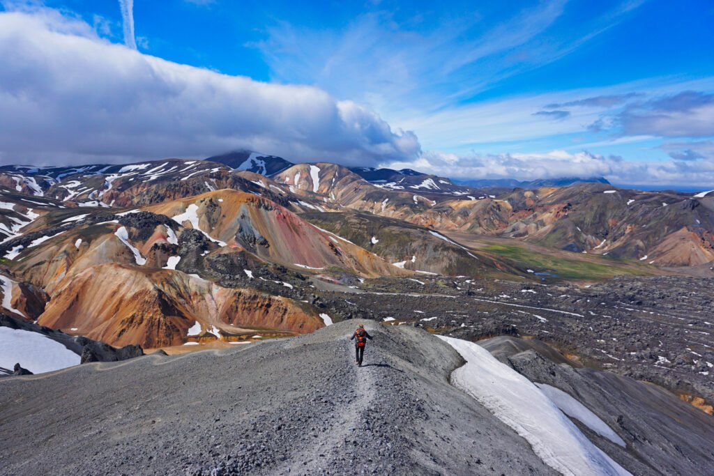
Situated in southern Iceland, the Laugavegurinn Trail is a must-see for nature enthusiasts and hikers alike. Spanning from Þórsmörk to Landmannalaugar, this stunning trail covers 55km (34 miles) of some of the most beautiful landscape that Iceland has to offer. With its vivid volcanic hills, glacial rivers and colorful rhyolite mountains, this hike will provide breathtaking views throughout.
The route usually takes 4-5 days to complete and is ideal for those looking to experience all that Iceland has to offer without spending too much time away from home. You can start at either end of the trail or do a loop of it if you have more time available. Regardless, this incredible journey through nature will leave you feeling invigorated and awed by its vastness.
Hikers should come prepared with sturdy footwear as the terrain can be quite rugged at times. It is recommended to wear layers as temperatures may vary between day and night along the way. Additionally, camping gear should be packed along as there are plenty of campsites dotted along the route. Be sure to fill up your water bottle at various rivers as these are freshwater sources for locals as well.
Those who venture along this epic path will also come across countless attractions such as bubbling hot springs, towering waterfalls, breathtaking viewpoints, and fascinating rock formations. Depending on your pace and desire for adventure, many trails branch off into nearby mountains for some challenging side trips and extra exploration opportunities. In order to make the most out of your trip be sure to read up on maps beforehand so that you don’t miss out on any of these gems!
From hikers looking for an intense challenge to travelers just seeking a peaceful wander amongst some of Mother Nature’s finest work; everyone should experience the Laugavegurinn Trail in Iceland at least once in their life! So pack your bags, lace up those boots, grab your map and get ready to explore all that awaits you along this magnificent trail!
Long Range Traverse, Canada

If you’re looking for an unforgettable trek through the wilds of Canada, the Long Range Traverse should be your first choice. Stretching for some 547 km (340 miles) from north to south, the traverse is one of the most impressive and challenging backpacking routes in North America. Spanning from Gros Morne National Park in Newfoundland to Cape Chidley on Labrador’s Ungava Bay, this journey will take you across spectacular wilderness that few ever get a chance to experience.
The best time of year for completing the Long Range Traverse is from mid-June to mid-September when snow levels are low and temperatures are comfortable. Although it’s possible to do it year round with winter camping gear, a spring or summer traverse is preferred by many. It’s important to note that while some sections may have existing trails, they are usually unmarked or infrequently used so come prepared with navigation skills and the right equipment!
The entire journey takes approximately three weeks and is broken up into six segments: St. John’s to Stephenville; Stephenville to Port aux Basques; Port aux Basques to Burgeo; Burgeo to Corner Brook; Corner Brook to Deer Lake; and Deer Lake to Gros Morne National Park. While each segment requires a minimum number of days, most experienced hikers complete it within two weeks by hiking between 8–12 km (5–7 miles) per day and completing an average of 18 km (11 miles) daily over multiple days. Keep in mind that if bad weather or trail conditions arise, there may be need for more than two weeks depending on individual speed and fitness level.
The route covers a wide range of terrain and scenic vistas including rolling hills, deep river valleys, majestic mountain peaks, highland moors and old-growth forests as well as stunning coastline vistas near some of the islands in Placentia Bay. Most parts of the hike provide beautiful views but even so come prepared with rain gear as you may face a downpour at any time along your trek. Make sure you bring all your own supplies like food, fuel and navigational equipment as well as basic safety items such as first aid kit and compass/GPS unit – bear spray is also highly recommended due to encounters with bears in this region. Additionally make sure you book transportation both before and after the hike so you can start on schedule without getting stuck at the beginning or end point.
A trek through Canada’s wilderness doesn’t get much better than the Long Range Traverse – no matter if it’s your first attempt or your tenth attempt this adventure promises a once-in-a-lifetime experience! So what are you waiting for? Pack your bags, hit the trailhead and explore one of North America’s great natural treasures!
John Muir Trail, USA
The John Muir Trail, also known as the JMT, is a 211-mile long hiking trail in the Sierra Nevada mountains of California. Named after conservationist and writer John Muir, the trail stretches from Yosemite Valley to Mount Whitney and passes through some of the most scenic and rugged landscapes in America.
The entire route is incredibly picturesque, with numerous panoramic views, high alpine meadows filled with wildflowers, and cascading waterfalls tumbling down steep cliffs. It’s a hike that many visitors look forward to tackling, but it requires quite a bit of planning and preparation.
The most popular section of the John Muir Trail is between Yosemite Valley and Tuolumne Meadows; this 65-mile stretch usually takes 4-6 days to complete and can be completed as part of a longer backpacking trip or even an overnight trip if time permits. This part of the trail takes you past several beautiful destinations including Cathedral Lakes, Cloud’s Rest summit, Little Yosemite Valley, and Half Dome – arguably one of the most spectacular sights in Yosemite National Park. There are numerous opportunities for camping along this section of the JMT with abundant streams for fresh drinking water.
From Tuolumne Meadows to Whitney Portal is a challenging 70-mile section that passes through alpine lakes such as Garnet Lake, pristine forests full of wildlife such as marmots, pikas and mule deer, granite domes reminiscent of Tuolumne Meadows, thundering waterfalls in Thousand Island Lake and remote landscapes like Evolution Valley where only those who attempt the journey will ever see them. While more difficult than other parts of the trail due to its higher elevations and rougher terrain, it rewards hikers with magnificent views and unparalleled experiences.
To experience the full beauty that John Muir Trail has to offer can take up to three weeks for an experienced hiker with ample time for exploration or rest. In addition to providing breath-taking scenery throughout your trekking journey along John Muir Trail (JMT), hikers may come across various plant life or wildlife while travelling on this natural route. After crossing all ten mountain passes while passing by dozens of serene lakes you reach Mount Whitney Summit -the highest peak in the lower 48 states- bringing you to another world before you make your descent towards Whitney Portal once again concluding your hike through John Muir Trail (JMT).
If you’re looking for an incredible outdoor adventure filled with majestic beauty then consider trekking on John Muir Trail! With so much to see along this legendary hiking trail it is easy to understand why it has been designated as one of America’s National Scenic Trails by Congress – making it a must visit destination for any adventurous traveler seeking unique adventures among nature’s wonders!
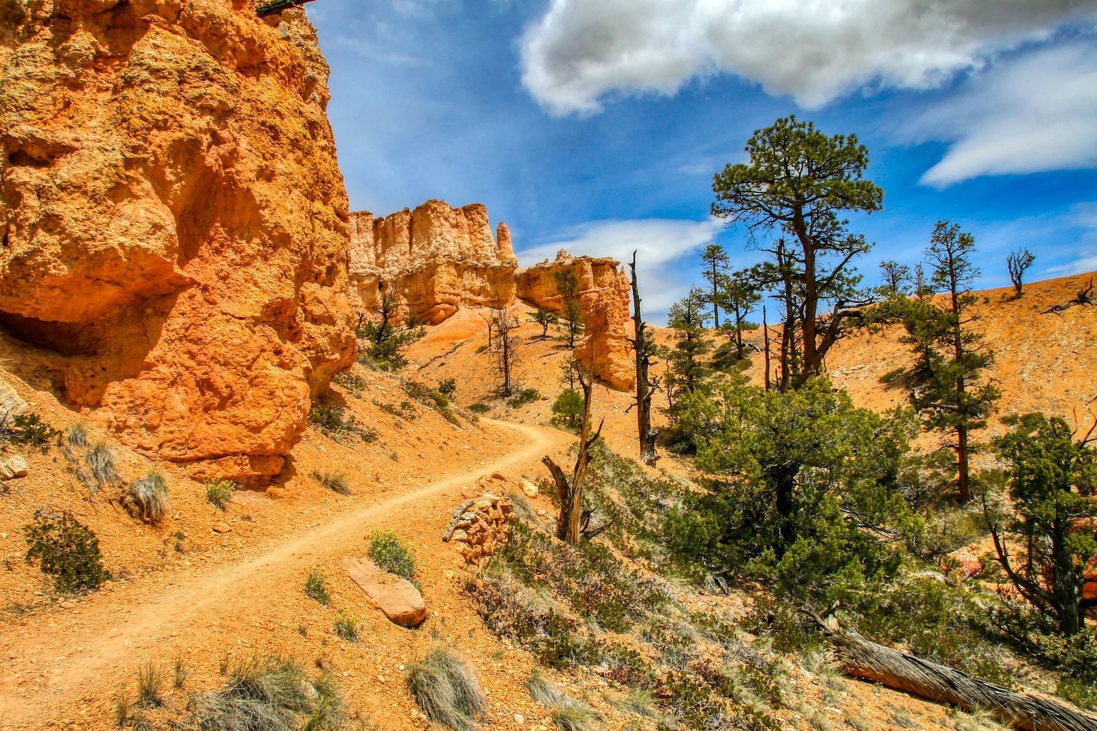
Torres del Paine Circuit Trek, Chile
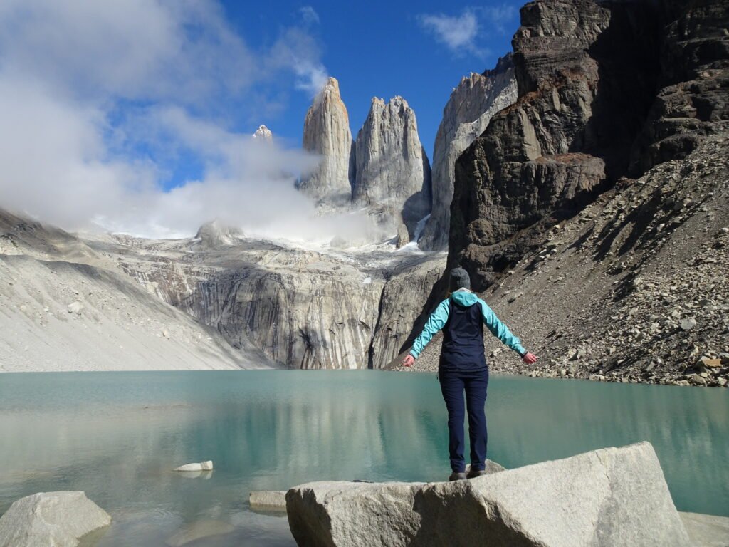
Are you looking for an unforgettable outdoor adventure in South America? Look no further than the Torres del Paine Circuit Trek, Chile. The route is a 9-12 day hiking loop that encircles one of the world’s most impressive natural attractions, located in the beautiful Chilean Patagonia region. This incredible trek is an iconic journey that passes through many breathtaking landscapes including mountain lakes, rugged glaciers and tranquil valleys, making it one of the most popular multi-day hikes in the world.
The circuit route generally starts and ends at a village near Puerto Natales. It begins with a steady uphill climb through the Valle del Francés (Valley of Frenchmen), passing spectacular panoramic views along the way. As hikers reach higher altitudes, they are met with towering mountains and vibrant lakes such as Laguna Verde and Nordenskjold Lake, before finally reaching Glacier Grey at nearly 5000 feet above sea level.
During this stretch of the trekking circuit, visitors will have ample opportunities to spot wildlife such as puma, guanaco, condor, flamingo and many species of birds along their way. From here on out, climbers can explore more glaciated terrain by taking offshoots like John Gardner Pass or climb up Los Cuernos del Paine Mountains.
Trekkers will eventually find themselves at Mirador Las Torres – the finale of the Circuit Trek – where they can marvel at some truly majestic towers while they savor every second before completing their loop around Paine Massif back to its starting point in Puerto Natales. During this final stretch hikers can look forward to postcard perfect scenery at Refugio Chileno and a plethora of green meadows inhabited by horses and wild donkeys at Ascencio Valley.
In terms of difficulty level, Torres del Paine Circuit Trek ranks high due to its elevation gain and prolonged physical exertion for multiple days straight; however its rewards far exceed any possible drawbacks as travelers come away from this incredible hike having seen some remarkable views and having had many unforgettable experiences that are sure to stay with them forever. So if you’re an avid hiker or outdoors enthusiast who’s planning a trip to Chile, be sure to add Torres del Paine Circuit Trek to your bucket list!
Kalalau Trail, Hawaii
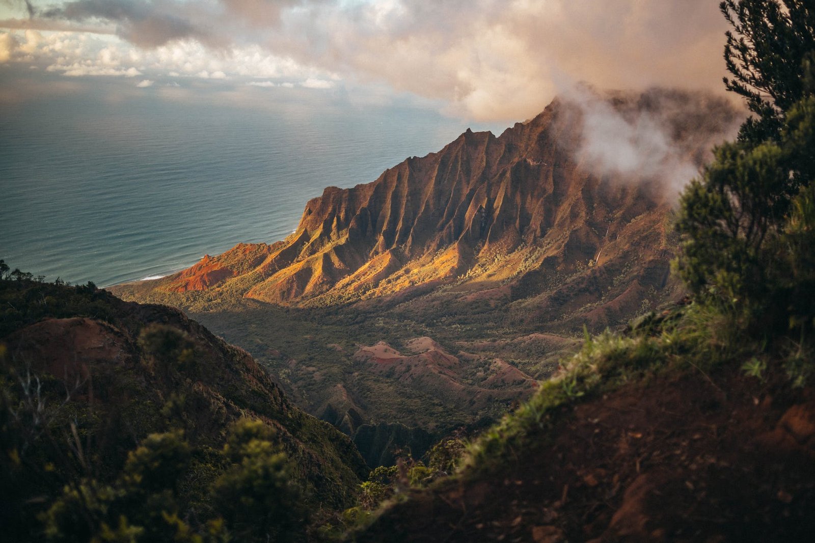
Kalalau Trail is an 11-mile (18km) hiking trail along the stunningly beautiful Napali Coast in Kauai, Hawaii. This iconic route, featured in numerous Hollywood movies such as South Pacific and Jurassic Park, is an amazing journey of scenic views, pristine waters and secluded beaches. With its rugged cliffs and lush valleys, it’s no wonder why Kalalau Trail has become one of the most popular destinations for outdoor adventurers in the world.
The hike begins at Ke’e Beach and travels across streams, rivers and past waterfalls before reaching its first stop at Hanakapi’ai Beach. At Hanakapi’ai, you can relax on the white sand or take a short hike to nearby waterfalls and pools. The trail then continues through verdant valleys and forests before ending at Kalalau Beach. Along the way, hikers are treated to breathtaking views of deep canyons and towering sea cliffs as well as amazing opportunities for photography.
Kalalau Trail is a physically demanding journey that requires travelers to be adequately prepared with supplies such as food, water and sun protection gear. The trek can take up to two days depending on how far hikers decide to venture but experienced adventurers should plan on three days or more for the entire hike. Camping along the way is permitted but requires permits from Kauai County which can be obtained from local parks offices.
If you are looking for an incredible adventure filled with picturesque landscapes then look no further than Kalalau Trail. A journey on this magical path will undoubtedly provide memories that will last a lifetime!
Snowman Trek in Bhutan

Are you looking for an exciting, yet peaceful and memorable journey? Then the Snowman Trek in Bhutan should be your next adventure! Known as one of the most challenging and spectacular treks in the world, this awe-inspiring trek traverses the peaks of the highest mountains of Bhutan.
Located in western Bhutan, the Snowman Trek passes through seven high mountain passes – with some reaching elevations above 4500m – and covers a distance of more than 250km over 23 days. It begins in Paro valley before going up to Drukyul (meaning Land of Dragons) which is also known as Bhutan’s “Last Shangri-La”. This area offers panoramic views of both Mount Chomolhari and Jichu Drake at 7314 meters and 6936 meters respectively. During your trek, you will pass through beautiful valleys, gorges, dense forests, snow-capped mountains, crystal-clear rivers, lush meadows, serene monasteries and many stunning viewpoints along the way.
The highlights of the trek include crossing over Renjo La Pass (5360m), Gangla Karchung Pass (5100m), Larkey La Pass (4900m) and three other spectacular mountain passes. The pass crossings are generally reached after about six hours walking uphill and provide breathtaking views that you will not soon forget! Additionally, during this trek you will experience Bhutan’s rich culture by passing through local villages, seeing their unique architecture and immersing yourself into their local customs. On this journey you will gain insight into Bhutan’s deeply spiritual culture by visiting traditional temples & monasteries such as Sakteng Monastery – located near Gangtey Gompa – as well as learning about important figures in Buddhist mythology including Guru Rinpoche (known to locals as ‘Gomchenpo’).
With snowcapped mountains that stretch endlessly around you and plenty of activities to keep you busy, a visit to Snowman Trek should not be missed out on when traveling to Bhutan!
Mount Kilimanjaro Trek in Tanzania
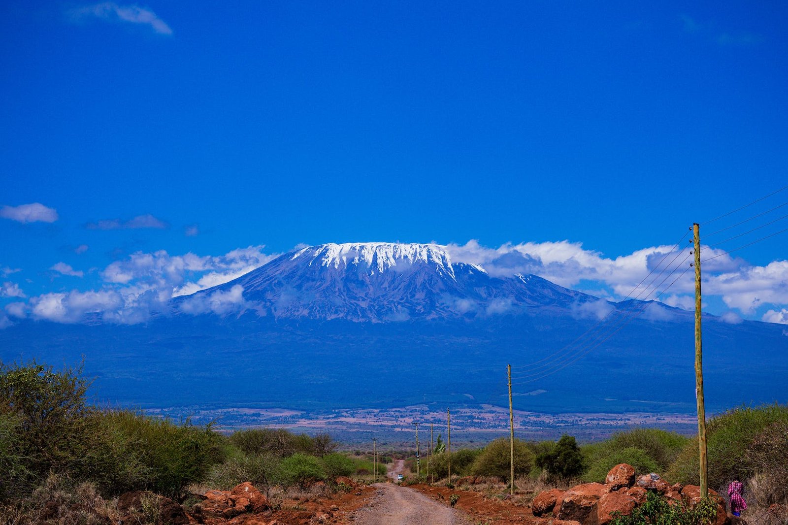
Mount Kilimanjaro in Tanzania is an epic trek for anyone looking for a unique adventure. The towering volcano stands at a breathtaking 5,895 meters above sea level and provides trekkers with stunning views from its summit. Although it can be challenging, reaching the top of this majestic peak is well worth the effort. With its diverse terrain, lush vegetation and fascinating wildlife, Mount Kilimanjaro in Tanzania provides one of the world’s most memorable trekking experiences.
For those wishing to attempt a Mount Kilimanjaro Trek in Tanzania, there are various routes available that offer different levels of difficulty. From Machame Route to Marangu Route and even Lemosho Route, each provides its own challenge and incredible rewards when reaching the summit. As with any hike of this nature, adequate preparation is necessary in order to ensure a successful experience. A thorough physical examination prior to the trip will help you determine whether or not you’re physically fit enough to take on the challenge. Proper clothing is also essential as temperatures can drop significantly during night time and above-the-clouds regions may have unpredictable weather conditions at any given time.
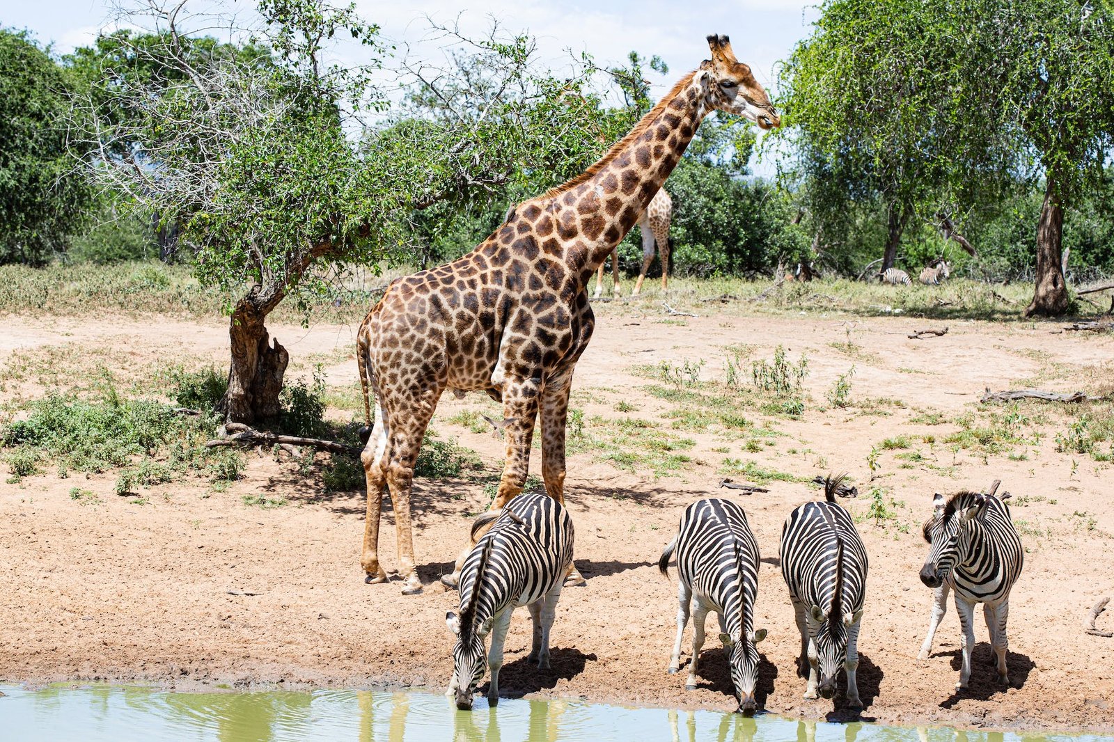
The beauty of Mount Kilimanjaro Trek in Tanzania goes beyond just reaching its summit; taking in its vast landscape offers some amazing opportunities for wildlife spotting too! Lions, leopards, hyenas and zebras all call the area their home so trekkers should keep an eye out for these magnificent creatures during their ascent and descent along various routes. Moreover, picturesque grasslands sprinkled with acacia trees surround the mountain providing a fantastic backdrop for nature photographers who seek something unique to capture on camera.
No matter which route you choose or how many days your climb may take – a Mount Kilimanjaro Trek in Tanzania will be an unforgettable experience! This ancient volcano stands proudly above African land inviting adventurers to come witness its majestic presence from up close – no other experience quite compares! So if you’re seeking adventure of epic proportions, then consider booking yourself on a Mount Kilimanjaro Trek in Tanzania – because where else can you ascend the tallest mountain in Africa?
Cotopaxi Volcano Expedition in Ecuador
When looking for a unique experience that will give you both adventure and beautiful landscapes, there is no better option than the Cotopaxi Volcano Expedition in Ecuador. Nestled in the foothills of the Andes Mountains, this extinct volcano stands at an impressive 5,897 meters (19,347 feet) above sea level. The snow-capped peak can be seen from many areas throughout the country and offers visitors breathtaking views and opportunities to explore a fascinating area.
The journey to the top of Cotopaxi begins in Latacunga, a town near Quito that serves as a base camp for most climbers. From there, it’s a full day trek to the summit, covering nearly 18 kilometers (11 miles). The first part of the climb takes adventurers through the paramo ecosystem – a wetland region filled with shrubs and grasses adapted to high elevations – until they reach the glaciers surrounding Cotopaxi’s summit.
The main difficulty in this hike is acclimatization: it’s essential to spend some time adjusting to thinner air as you ascend so that you don’t become sick during your journey. Taking two days for your climb gives your body enough time to adapt; it also ensures that you have plenty of time to appreciate your surroundings and take in the views from different parts of the mountain. This includes opportunities to observe some of Ecuador’s wild llamas grazing along nearby trails and possibly catching sight of soaring condors as well.
Cotopaxi’s summit marks one of several experiences offered by its vicinity. In addition to climbing up towards it, there are options for mountain biking, hiking around other volcanic peaks such as Rumiñahui and Pasochoa, visiting an archaeological site nearby or touring Lago Quilotoa, an emerald crater lake situated close by at 3,914 meters (12,842 feet) above sea level. No matter what activities travelers choose while visiting Cotopaxi National Park they will certainly get their fill of stunning natural beauty while on their trip!
The Cotopaxi Volcano Expedition provides climbers with incredible experiences during every stage of their journey – from meeting locals in Latacunga all the way up to gazing out over miles upon miles of breathtaking scenery from its summit. If you’re looking for an unforgettable adventure amidst gorgeous vistas and vibrant cultures then make sure you add Cotopaxi Volcano Expedition in Ecuador onto your travel bucket list!
Drakensberg Grand Traverse in South Africa
The Drakensberg Grand Traverse is an awe-inspiring journey across South Africa’s beautiful Drakensberg mountain range. This strenuous backpacking trip will take you from northern Lesotho, to the Garden Castle, then through to the Sentinel car park in KwaZulu-Natal. Along the way, you’ll get to experience some of the country’s most spectacular landscapes and get a real taste for what South African hiking is all about.
The trek itself is quite demanding – covering a total distance of approximately 350 kilometers (218 miles), so you will need to make sure that you are adequately prepared both mentally and physically before attempting it. If possible, plan on spending at least 14 days on this journey; although some people have managed it in just seven days. Depending on how fast or slow your pace is, it might be necessary to bring more food supplies with you as well.
The trek follows mostly unmarked paths, so it would be helpful if you were familiar with basic navigational skills prior to starting out. The first part of the hike goes up and over the magnificent Amphitheatre and takes between five and six days – which includes plenty of rest stops and lots of time for soaking up your stunning surroundings. From here, you can go off exploring one of several side trails in search of majestic waterfalls or ancient bushman rock paintings if time allows.
You’ll also find plenty of crystal-clear streams during your traverse where you can stop off for a much needed refreshing dip or fill up your water supply (which is especially important when temperatures rise). All throughout the trip you’ll get plenty of chances to appreciate unique fauna and flora such as majestic elands and other antelope, rare plants like proteas and king proteas as well as an incredible array of birds chirping away as they flit between trees – this is truly one magical environment that cannot be matched by any other trail in South Africa!
As you come towards the end of your hike there are two routes that join together again: either south through Bergville or eastwards via Giants Castle Nature Reserve (where depending on your luck you may spot some wild baboons!). At the end lies the beautiful foothills below Sani Pass where your traverse will finally come to a close; rewarding yourself with amazing memories that will last forever.
Whether or not it’s actually achievable, tackling the Drakensberg Grand Traverse should definitely be on everyone’s bucket list – this is an opportunity for experienced hikers to really test their physical strength against nature’s own forces while also taking time out for breath-taking scenery along its course. So start planning today for an epic journey across South Africa’s extraordinary mountain ranges!
Cape Wrath Trail in Scotland
Are you looking for an exciting adventure to embark on this summer? Look no further than the Cape Wrath Trail in Scotland. This 180-mile trail offers hikers some of the most beautiful and rugged scenery in the world, and it’s sure to be a rewarding experience like no other.
The Cape Wrath Trail takes its name from Cape Wrath, the northernmost tip of mainland Scotland. It was first conceived as a way to traverse through the remotest parts of Scotland, and so has earned its reputation as one of Britain’s most challenging trails. Although it can be tackled in 10 days or more if desired, there is no time limit and most walkers take up to two weeks. The trail winds its way across heathlands, moors and hills, past glens and lochs (lakes), before eventually reaching Cape Wrath itself. Along the way, hikers can expect plenty of varied wildlife including deer, foxes and badgers as well as buzzards, kites and eagles flying overhead.
On this hike, travelers should expect plenty of variety: a great mix of landscapes ranging from open grassland with ancient cairns marking high points; wooded glens where visitors will often have riverside camping spots to themselves; undulating moorland strewn with old ruins; dramatic coastal sections; deep ravines containing small waterfalls that demand close attention when crossing them; stunningly beautiful sand beaches fringed by turquoise waters dotted with otters and seals; lush pastures home to red deer; hard mountain passes to conquer… And much more! As a bonus for all your hard work, once you reach Cape Wrath you’ll be rewarded with views that stretch out over miles of empty sea towards Iceland and Greenland.
Throughout your journey you’ll pass through many traditional towns along the route including Inchnadamph near the start of your hike and Strathcarron near its conclusion. While on your travels you may also pass other travelers on bikes or on horseback who use sections of the route during their adventures as well.
Cape Wrath Trail is suitable for any level hiker who is fit enough to cover 12-15 miles per day at an average speed — depending upon terrain underfoot — whilst carrying necessary supplies (which should include maps/compass, torch/flashlight/spare batteries, appropriate clothing). Bear in mind too that while much of the trail can easily be followed without difficulty (using signs), a large proportion follows unmarked tracks where compass navigation skills are essential — especially in foggy weather or if nightfall threatens early (it’s advisable to never navigate after dark!). On top of this cautionary note though it’s worth adding that this amazing challenge does indeed reward those who complete it with an unforgettable adventure!
Grand Canyon Rim-to-Rim Hike in Arizona (USA)

For the experienced hiker and outdoor enthusiast, Arizona’s Grand Canyon is one of the ultimate goals. This iconic location offers stunning views and an opportunity to traverse one of the world’s most impressive natural wonders. And with a full day of trekking, visitors can make the awe-inspiring journey across the canyon’s South Rim to the North Rim and back—an experience known as a “Rim-to-Rim” hike.
The Rim-to-Rim trail spans 22 miles from the south to north rim. It starts off at 8,500 feet in elevation and ends at 6,800 feet for a total descent and climb of about 4,400 feet combined. On average it takes 9 to 12 hours for the full roundtrip hike so its recommended that hikers plan for an early start before sunrise in order to make it back safely. Since this trail crosses such extreme terrains it is essential that hikers bring ample amounts of water along with high energy snacks as there are no resupply points on this route.
As you traverse along this epic adventure, take time to appreciate nature in all its glory: listen to the music of bird songs or stop at scenic vistas where ancient canyon walls rise majestically in every direction. From sections like Bright Angel Trail that feature high sandstone cliffs where waterfalls cascade into the depths below or view point’s like Ribbon Falls that give you an opportunity for majestic canyon photo ops –every step will surely leave lasting impressions for any traveler seeking true outdoor immersion.
Although safety should be top priority during any outdoor adventure, there are several additional hazards present on this route like temperature swings, which can range anywhere from 45F – 85F depending on what season you visit, so make sure to wear clothing layers appropriate for sudden climate shifts. It’s also important that hikers wear quality hiking boots designed with supportive arch protection since much of the terrain consists of rough rock faces that could lead to painful foot cramps and muscle strains if left unprotected during long days on your feet.
The Grand Canyon is home to numerous plant species, reptiles and other creatures which may pose their own risks when encountered but following proper protocol should reduce those chances significantly—i.e., stay away from snake pits! Additionally its worth noting that if your crossing time surpasses five hours then its important you update a loved one with your exact coordinates in case anything were to go wrong—a simple precaution goes a long way when tackling these type of adventurous feats!
Grand Canyon Rim-to-Rim Hike provides more than just physical challenge; this unique journey allows participants an exclusive insight into some of nature’s best masterpieces –captivating memories destined last lifetime! With enough preparation, tenacity and discipline—hikers can turn dreams into reality by conquering one of America’s most celebrated destinations!
Mt Toubkal Climb in Morocco

If you’re looking for an adventure that combines the thrill of climbing, breathtaking views and unique cultural experiences, then a climb up Morocco’s highest peak – Mt Toubkal – is a must-do. Located in the High Atlas Mountains, it stands at 4,167m and is an exciting challenge that many experienced climbers take on every year.
A Mt Toubkal Climb starts with a journey to Marrakech. From there, climbers take a bus or taxi to the Imlil Valley in the High Atlas Mountains where they meet their guides and porters. Acclimatisation is important so there are stops made along the way including those in small villages with amazing traditional architecture such as Aroumd and Imlil.
Once you arrive at your base camp you’ll get to know the group before heading out to begin the trek up Mt Toubkal. On day two, climbers set off from Sidi Chamarouch to Neltner Refuge – this part of the route involves crossing mountain passes, ascending through terraced fields and then winding around an avalanche-prone cirque filled with stunning views over rivers, snow-covered peaks and lush meadows.
At nightfall climbers sleep at Neltner Refuge – if weather conditions are clear enough then make sure you look out for some of the best star gazing opportunities imaginable! On day three adventurers complete their Mt Toubkal climb by summitting its peak before returning down via Jbel Ouanoums. It’s possible to complete this trek in three days but four-day itineraries include overnight stays in a few other valleys en route which adds even more of a magical touch to the experience!
Overall, Mt Toubkal Climb provides people with a memorable journey filled with unforgettable moments like climbing through lush meadows beneath snow-capped mountains; passing ancient Berber villages full of fascinating stories; learning about local customs and cultures; savouring beautiful Moroccan cuisine and perhaps most importantly connecting with nature. Whether you choose to do it independently or join an organised tour this incredible feat of outdoor endurance will certainly leave you with many amazing memories that will last forever.
Annapurna Circuit in Nepal
The Annapurna Circuit in Nepal is one of the most popular and rewarding trekking routes in the world. Spanning a total distance of 210 kilometers, it offers trekkers a spectacular journey through the diverse terrain and scenery of Nepal’s mountainous regions.
The trail passes through various altitudes ranging from 850 meters to 5,416 meters above sea level and winds through a mix of tropical rain forests, high-altitude terrains, and remote mountain villages. This variety makes the Annapurna Circuit an especially exciting trek as trekkers experience changes in elevation, climate, and landscape.
Starting in Besisahar, the Annapurna Circuit takes around 12-15 days to complete depending on fitness level and desired sightseeing stops. Along the way you’ll come across plenty of breathtaking viewpoints like those found at Thorung La Pass (5416m), Chame (2713m) and Tatopani (1190m). Each destination presents a different vista – snowcapped peaks one day, deep gorges the next – so make sure you bring along a camera for all the special moments.
Other highlights include trekking through Jomsom Valley where you can observe colorful Tibetan Buddhist cultures; admiring waterfalls at Ghorepani; seeing closeup views of fishtail peaks, Tilicho Lake; visiting temples at Muktinath; climbing up Dhampus peak; and discovering Kali Gandaki Gorge -the deepest gorge in the world! There is something new to be experienced every day of this adventure.
No matter which part of the Annapurna Circuit route you explore, rest assured that your time there will be full of great experiences with incredible sights along the way. To maximize your enjoyment during this once-in-a-lifetime experience, make sure you plan ahead by researching about trekking times between destinations, stocking up on essential supplies such as food and water, familiarizing yourself with proper hiking gear, and arranging accommodations or guided tours in advance if necessary. With these precautions taken care off prior to your journey, you are sure to enjoy every second spent on Annapurna Circuit!
Huayhuash Circuit Trek in Peru
If you are looking for an unforgettable trekking experience in the Andes, look no further than the Huayhuash Circuit Trek in Peru. Located in the heart of the Cordillera Huayhuash range, this circuit trek offers travelers a stunning landscape and some of the most breathtaking scenery imaginable. Along this approximately six-day trek, you will be surrounded by rugged mountain peaks, stunning alpine lakes, vast glacial valleys and turquoise lagoons. It’s easy to see why this route is so popular with experienced hikers and backpackers from all over the world!
The Huayhuash Circuit Trek begins at either Llámac or Matacancha, small villages located on opposite sides of the mountains. Whichever starting point you choose, it is highly recommended that you hire local guides and pack horses for the duration of your trek. The combination of their knowledge of the area and assistance with transporting gear will make for a much more enjoyable and safe journey.
Once on the trail, expect to encounter many challenges along the way as well as breathtaking views. During your trek, you will pass by eight mountain peaks exceeding 6,000 meters (19,680 feet), including Yerupaja Chico (6121 m/ 20 060 ft.), Siula Grande (6344 m/ 20 801 ft.), Yerupaja (6634 m/ 21 761 ft.), Carnicero (6400 m/ 20 976 ft.), Jirishanca (6094 m/ 19 999 ft.) and many more spectacular mountains. Furthermore, numerous lakes including Solteracocha, Jahuacocha and Carhuacocha are situated alongside each peak – perfect spots to stop and rest before continuing on your journey.
One unique feature that sets Huayhuash apart from other treks is its crystal clear rivers filled with trout and goldfish – perfect for anglers! After several days in the backcountry wilderness, end your expedition with a visit to Lake Viconga which serves as an ideal location for one last picnic or swim before heading back home.
Whether you are seeking a leisurely hike through pristine mountain passes or a thrilling adventure through dramatic terrain – Huayhuash Circuit Trek in Peru promises to deliver both in abundance! From stunning views of majestic snow-capped peaks to excellent opportunities for wildlife viewing – this iconic circuit is certainly one worth experiencing!
Conclusion
From majestic mountain peaks to untouched forests, from historical routes to captivating coastal walks, there is something for every nature enthusiast. Whether you’re a novice hiker or a seasoned explorer, these amazing trails offer unique and unforgettable experiences that will have you coming back for more. With some of the most breathtaking landscapes on the planet and a wide variety of hiking options to choose from, these are the 20 best hiking trails in the world.
Do you have any hiking trails in your mind that must be submitted in the 2o best hiking trails in the world, then comment below.


Pingback: Best Hiking Trails in Virginia - HikePackers
Pingback: Hiking in Finland - A Magic Glimpse - HikePackers
Pingback: Hiking in Canada - Top 10 of The Best - HikePackers
Pingback: Salomon Speed Cross 5 Review: The Ultimate Trail Running Shoe - HikePackers