
KILLING KILI POLE POLE (SLOW SLOW)
Who is Godliving Bayona?
My name is Godliving Bayona (Kobe). I’m a tourism and leisure enthusiast, 26 years old, I’m a professional mountain guide and I have been to the top of the mountain over 59 times, for four years now Kilimanjaro has been my office. I’m a graduate with a bachelor’s degree in the Wildlife Management program at the College of African Wildlife Management MWEKA. I’m an avid basketball player and fan and Mount Kilimanjaro is my office!
My story with Kelvin and Ruth to Kilimanjaro
I got a call from Justine, a friend of mine who had a homestay in Arusha named Nyumbani Airbnb (Northern Tourism Circuit of Tanzania). He had two clients who had already done mount Meru, in preparation for the Kilimanjaro trek so as to catch up with attitude and for physical preparation for the Kilimanjaro trek. Height of 4,566 meters (14,980 ft), Mount Meru is a dormant stratovolcano located in Arusha National Park, 70 Kilometres (43 miles) west of Mount Kilimanjaro in the country of Tanzania. Mountain Meru is the second-highest mountain in Tanzania 4500Masl. So Justine asked me to be their guide.
The next day I went to Arusha from Moshi 75KM drive, At Justine homestay (Nyumbani Airbnb). I met this beautiful couple Kelvin and Ruth, we made stories for some time before I started briefing them about everything to expect on our trek. After I was done with the briefing I checked if they had all gears needed for the trek, they had to rent a few things. Late in the evening I left and headed back to Moshi town.
About the mountain and the route we choose…
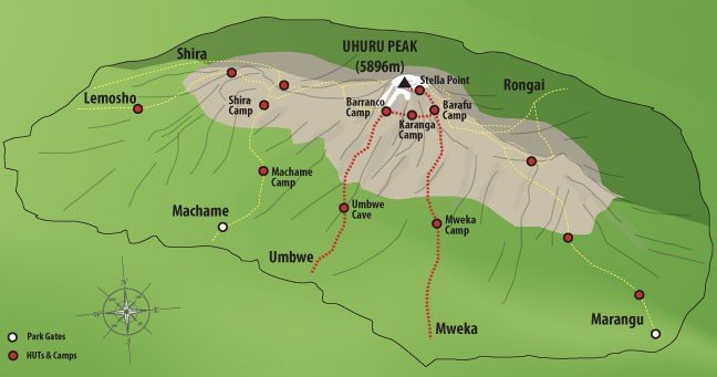
Mt. Kilimanjaro is the highest free-standing mountain in the world. The top of it, at Uhuru Peak, is 5,895 meters (19,340 feet) in altitude.
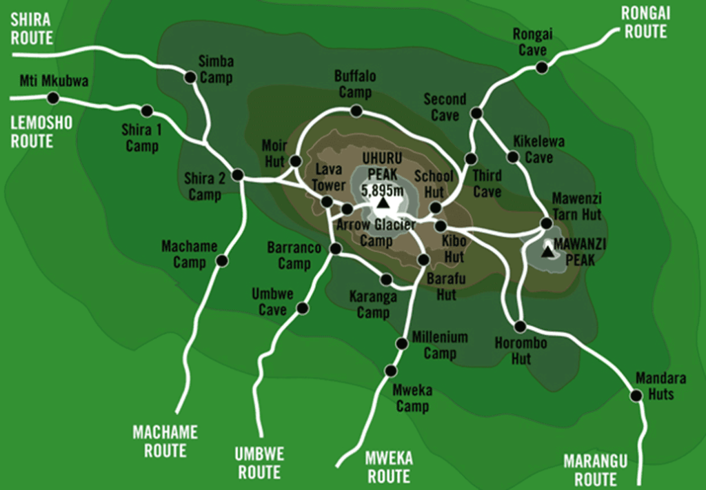
There are 7 established routes to the top of the mountain. We did the Machame route. This route can be done in 6 days or 7 days. They choose the 7-day route to give them a higher chance of success to get to the top. In fact, this route has an 85% success rate. I thought their odds were even better than that, given that they acclimatized a little bit by doing the Mt. Meru climb just a few days ago.
There are no huts on the route chosen. So we will be sleeping in a tent. There are also no flushable toilets. So, I warned them to have their expectations low! The toilet facilities will not be pleasant. Many people actually pay for a porter to carry a portable chemical toilet and private tent up the mountain for them. While this would be a much more pleasant experience, Kelvin and Ruth could not justify paying someone to carry a toilet up a mountain just for their comfort and convenience! But, we hoped that the number of trekkers is down that year due to COVID 19 pandemic, so maybe the facilities won’t be so bad. Nonetheless, we were expecting them to be bad.

They were feeling confident, but they wouldn’t t continue if they were having problems. That is, the one who is having problems won’t continue. They decided that if one of them is still good to go, that person should continue. As I told them many times, Kilimanjaro is unpredictable, so who knows what is going to happen.
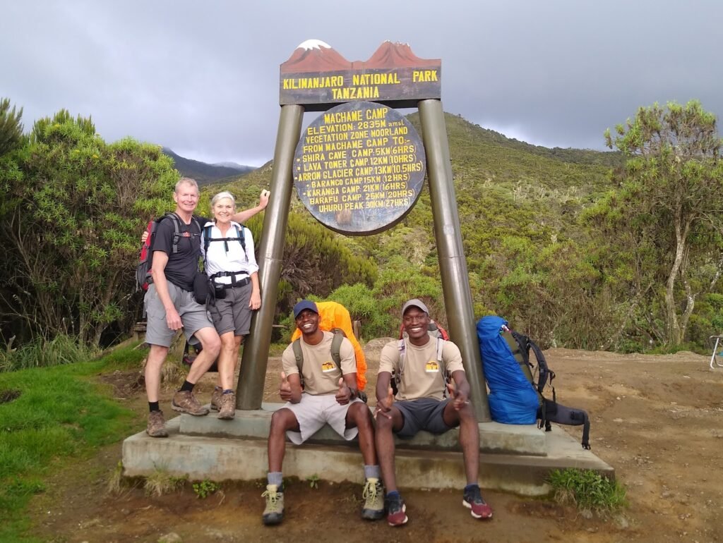
Kilimanjaro Day 1 – Machame Gate to Machame Camp 9,300′ altitude

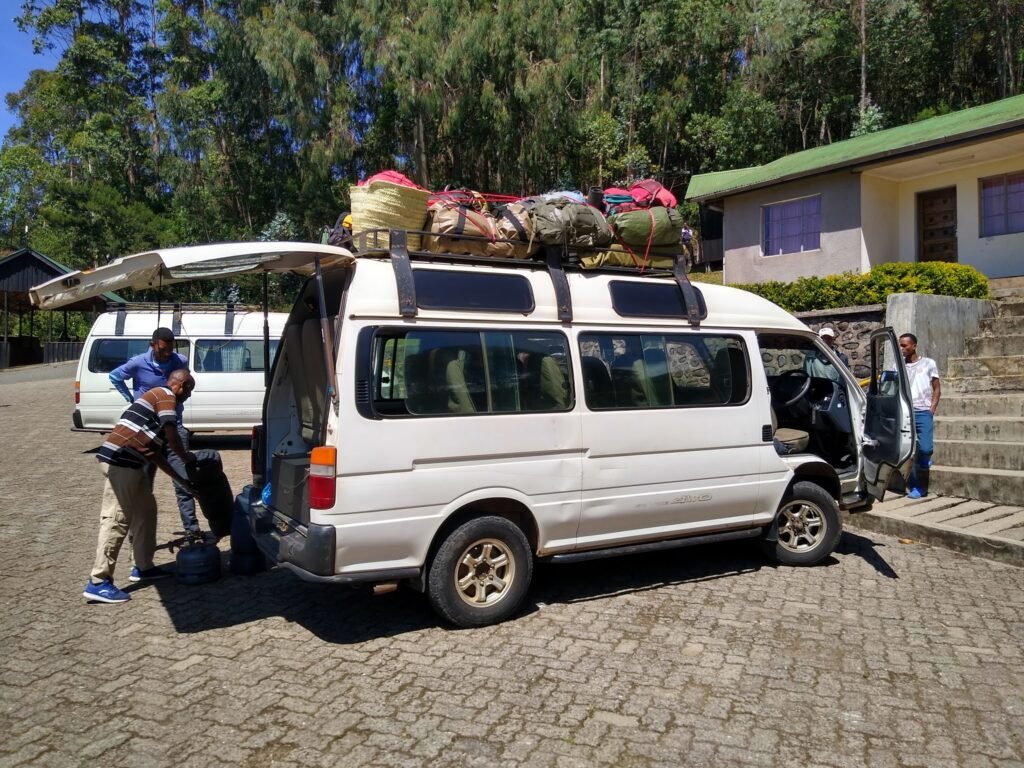
Day 1 started at 7:00 am in Arusha. They then had a two-hour drive from Arusha to Moshi, and they stopped at several places to pick up either people or gear. There is a lot of logistics involved with getting two people to the top of Africa… and we were a crew of a total of 11 people helping them get there!
We were two guides, me and Shalali, our cook Martin, and eight porters carrying the gear and supplies needed for seven days and six nights on the mountain!
Our first day hike is from there to the Machame Camp at 2,835 meters (9,300 feet), an elevation gain of 1,035 meters (3,400 feet) over 10 km (6.2 miles).
Kelvin and Ruth had some more time to wait while permits and paperwork were completed. They sat in an outdoor covered lunch area and they were given box lunches to eat. They snacked on a few items and left some for the hike itself. While I and Shalali were finalizing the paperwork at the Machame gate offices and the weighing of the luggage for the porters to carry.
While Ruth and Kelvin were waiting, they got to talking to some others who were following the same route and schedule as we were. There was a single (late 20’s?) Polish girl who lives in London, and a brother and sister couple (also late 20’s?) from Russia.
Part of what we were waiting for was for the porters to have all the gear weighed. Each porter is allowed to carry a maximum of 20 kgs (44 lbs) of gear. Interestingly, it’s a custom that once inside the park they spread the weight around because some guys can carry more. It’s absolutely mind-boggling how the porters do the same route that we do while carrying all this weight. And, they do it much faster than we do!, Despite the fact that they are acclimatized to the weather condition but they also have to prepare the tents for clients before clients are at the campsite.
Kelvin and Ruth were surprised by the facilities. Each camp has a park ranger station and several different bathroom facilities. Normally, these camps would be full of people and tents. They would not have wanted to do this hike when there would normally have been so many people also doing the same thing. So that was the perfect timing.
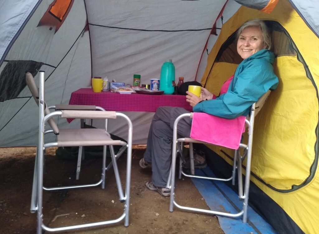
Upon reaching the campsite Kelvin and Ruth were served hot water in a thermos, and instant tea, coffee, and hot chocolate. And a plate of fresh popcorn!
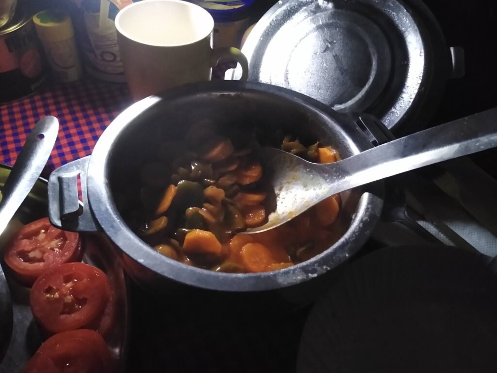
Then Kelvin and Ruth were served dinner. When they arrived they were brought bowls of hot water for washing up. Dinner was served at 7:15 pm. Soup for starters. Dinner was fish and chips! And vegetables.
There was always enough food. They tried their best to finish it all. We really stress them to eat a lot and drink a lot of water to keep them energetic at all times and hydrated. Drinking a lot of water is one of the things you have to do to help your system get used to the altitude. For me and Shalali, the food was brought directly into our tent, and the utensils would be collected from there.
Of course, the problem with drinking lots of water is that you have to pee more! This is not fun when you are sleeping in a tent and the bathroom facilities aren’t close by. And no, the park rangers are not happy if you just step outside your tent to pee. You need to use the facilities as provided unless, of course, you are on the trail.
Fortunately, someone had told Kelvin and Ruth before the hike started that they need to have a pee jug in the tent, and they had bought one beforehand. This made a big difference, and when they mentioned it to some of the others, they wished they had one too.
So, we slept our first night at 2,835 meters (9,300 feet). We had a good day, and Kelvin and Ruth were feeling good! The hike was an uphill climb all the way, but they had done the day hike before. What they had not done before was this type of hike 6 days in a row, with ever-increasing altitude.
Kilimanjaro Day 2 – Machame Camp to Shira Cave Camp 12,300′ altitude
Our waiter woke Ruth and Kelvin up at 6:30 am and they did some washing up and had a good breakfast. There was always hot water for tea, coffee, or hot chocolate, and lots of fruit and millet porridge every day. Kelvin ate to his fill, but I later realized he didn’t really like millet porridge, and he was honest that he would be happy to never see a bowl of millet porridge again. That his mother used to make it when they were kids, and he didn’t enjoy it then either! Then there would be some eggs and sausage and some kind of cassava bread. We made it very clear to the cook about Ruth being gluten-free, so he was well aware of Ruth’s gluten-free diet.
By 8:20 am, we set off for a 5 km (3 miles) hike that would bring us up another 878 meters (3,000′) in altitude.
This was probably our easiest day of trekking, although it was still hard going for the old couple. We managed to do about one kilometer per hour!
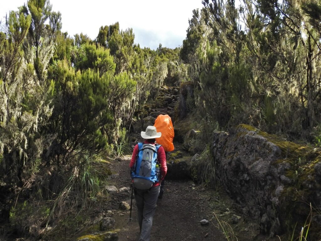
But the weather on Kilimanjaro can change in a heartbeat. Every evening it’s a custom to brief the clients, so I and Shalali would explain what to expect the next day, what they needed to wear, and what they needed to carry in their day pack. Anything else would be carried by the porters in the big rental duffel bags. But anything left in the bags wouldn’t be available to the clients until we arrived at the next camp.
And every day, we had to have our rain ponchos, and three full liters of water each! mostly for the clients. Being used to attitude sometimes the guides do not abide much to this.
Interesting scenery.
Yes, They were so good at following our advice! The scenery along the way!
Notice that some clouds have moved in.
A pretty flower called a Mackinder’s Gladiolus More clouds.
Climbing uphill. Stopped for a snack.
The white-necked ravens that you see in the photo above were at all of our stops, including all of the camps. They aren’t shy, and if you leave anything edible close by they will snatch it!
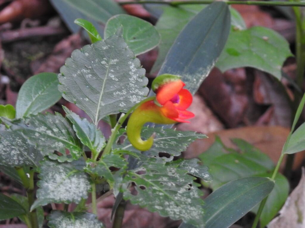
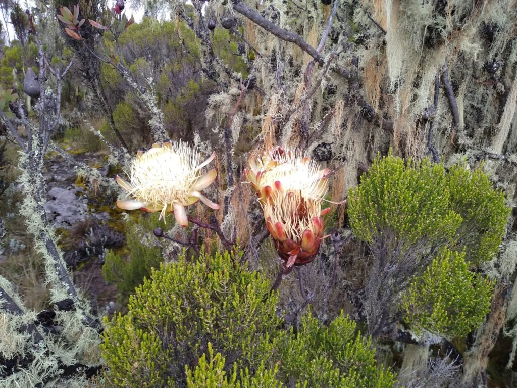
Vegetation along the way, is called an Everlasting Flower.
Wow. I love this scenery!
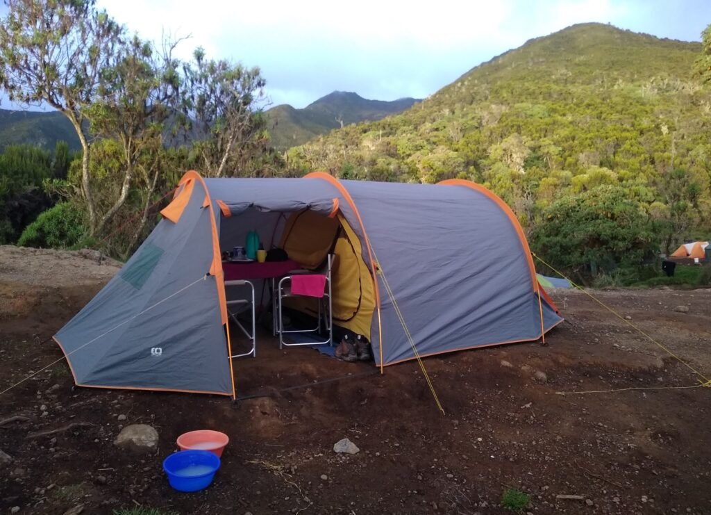
Made it to Shira Cave Camp.
To Kelvin, Shira Cave Camp was probably the least favorite from a scenery point of view. We arrived there at about 1:20 pm and the stomach engineer (the term we use to address the cooks) made a nice hot lunch. After that, they had a nap and then explored some of the areas.

The cave!
This camp would normally have three or four times as many tents set up.
Our crew!
Clients don’t really have much interaction with the porters with the exception of the one who doubles as your waiter. Our guy was Hallelujah. Every time he sent food or went to Kelvin and Ruth’s tent to wake them up he was so cheerful, and he would attach the word Hallelujah to just about everything he said. He is always a real pleasure to have around, and a great part of the crew. And I normally have him in most of my treks as a porter and a waiter.
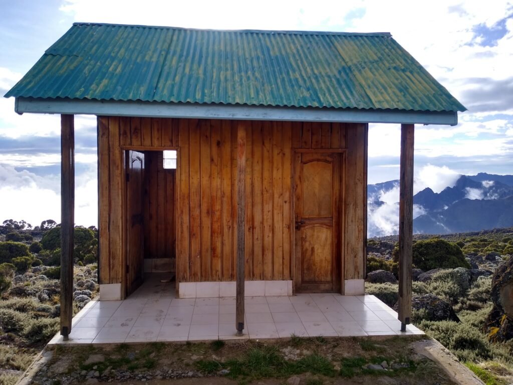
One of the toilet huts…!
Generally, the facilities were in better shape than Kelvin thought they would be. It takes a bit of practice to get used to these “squat” facilities, and no, they are not the nicest! Kelvin said. Most people are apparently not very good at squatting, and they are also not very good at cleaning up after themselves. We warned Ruth and Kelvin that it was best to use the facilities in the morning when things were still cold enough outside that the odor was a bit more subdued!
Outhouse with a view!
I love this shot!
Ruth, relaxing outside our tent with a view of snowy Kilimanjaro.
Sunset.
Night two was spent at 3,750 meters (12,300′) altitude.
Normally at this altitude, you start to notice it. Just little things like getting out of bed to make you huff and puff a little bit. But we were about to go much higher!
Kilimanjaro Day 3 – Shira Cave Camp to Barranco Camp 13,050′ altitude
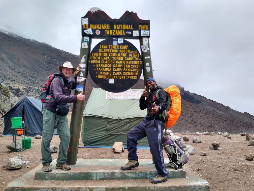
We were up at 6:30 am again. A fairly big day ahead of us as we were going to hike up to Lava Tower at 4,630 meters (15,190 feet) in time for lunch, and then back down the other side to Barranco Camp at 3,976 meters (13,050 feet) over a total distance of 9.7 km (6.0 miles).
The stomach engineer made us a packed lunch, and we got going at about 8:10 am.
It was a beautiful clear start to the day, but chilly. It still didn’t go below freezing, you realize it because water bottles still had liquid in them. But it must have been close to 0C (32F) when we got up. But the weather on the mountain changes constantly. It can go from perfectly clear to totally overcast and foggy in a matter of 20 minutes or less.
And there are five distinct climate zones on the mountain.
The base of Kilimanjaro is the cultivation zone. There are many farmlands having fertile volcanic soil. This area gets ample annual rainfall.
The rain forest zone is next, where you trek through jungle greenery. As expected, it rains almost every day in this area. Annual rainfall in the area averages 60 inches.
Then is the moorland zone. As you exit the rain forest, the change is dramatic and almost instant. Temperatures now begin to cool.
Next is the alpine high desert zone. It is windy and drier, and only hardy small plants survive.
At the top is the arctic zone. There is precipitation, but it generally falls as snow.
A clear view of the mountain at 6:45 am.
And a clear view of Mt. Meru in the distance. Still, a great day at 8:45 am.
But by 9:00 am, the clouds are moving in.
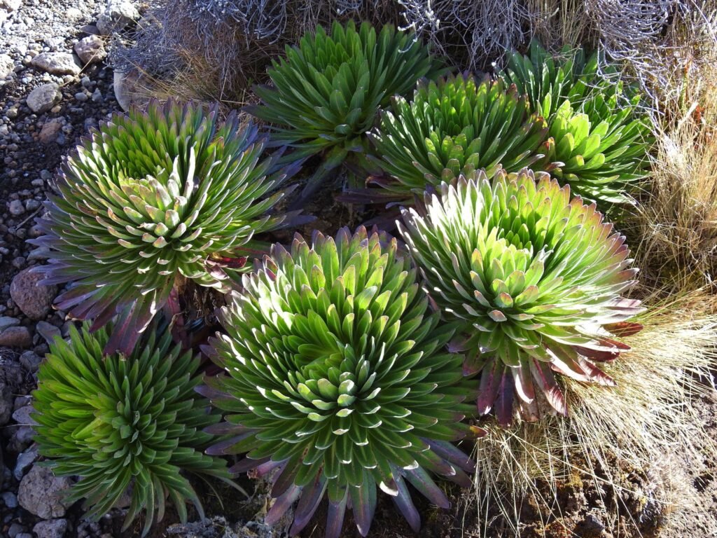
Mountain vegetation, young Giant lobelia.
The porters will take a detour to Barranco Camp.
We are hiking a longer route to Barranco Camp. One that takes us up to Lava Tower at 4,630 meters (15,190 feet). This is where we will sit and have lunch for an hour. We take this route specifically to help acclimatize your body to the higher altitudes. Then we go to the lower Barranco Camp to sleep for the night.
At 11:20 am, the clouds had moved in. Lava Tower.
This little fellow followed us for a while.
Made it to Lava Tower 4,600 meters (15.190 feet) at 12:50 pm.
There are still 18 km (11.2 miles) to the summit!!!
17 hours!
There is a camp at Lava Tower as well, but we would not be staying at this camp. Our route takes us back down to Barranco Camp for the night.
We sat and had lunch at Lava Tower.
Coming down the other side of Lava Tower. It was cooler, and the wind had picked up.
Giant groundsel.
This breed of plant is only found in small localized pockets at water catchment areas and only on Kilimanjaro! It’s scientific name is dendrosenecio kilimanjari. It’s very well adapted to the weather condition up there as it folds its dried leaves covering the stem and below the leaves, there’s a cotton-like material all to protect the plant from harsh, cold, and windy weather conditions up there. These plants are found mostly above 3500Masl.
Waterfall in the zoomed-in.
Made it to Barranco Camp at 3:40 pm.
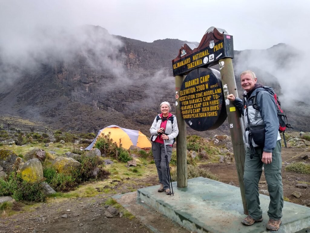
At our meeting that evening, I and Shalali shared some bad news with our clients.
The weather forecast for the summit was very poor for February 7, 8, and 9. Our original schedule called for us to attempt the summit in the early morning of February 7th, and we recommended that we do it a day ahead of schedule for the best possibility of success.
That would mean skipping Karanga Camp and going directly to Barafu Camp the next day. One less day of acclimatization, and tomorrow’s hike would be 8 to 10 hours and 9 km (5.4 miles).
We know best, and they trust us. So they agreed to the new plan. They knew we would have a tough couple of days ahead of us. And we made that clear.
Kilimanjaro Day 4 – Barranco Camp to Barafu Camp 15,330′ altitude
Because of the upcoming bad weather, it was going to be a long day. We were going to skip right by our originally planned stop at Karanga Camp and continue on up the mountain to the Barafu Camp where we would spend the night at 4,673 meters (15,330 feet).
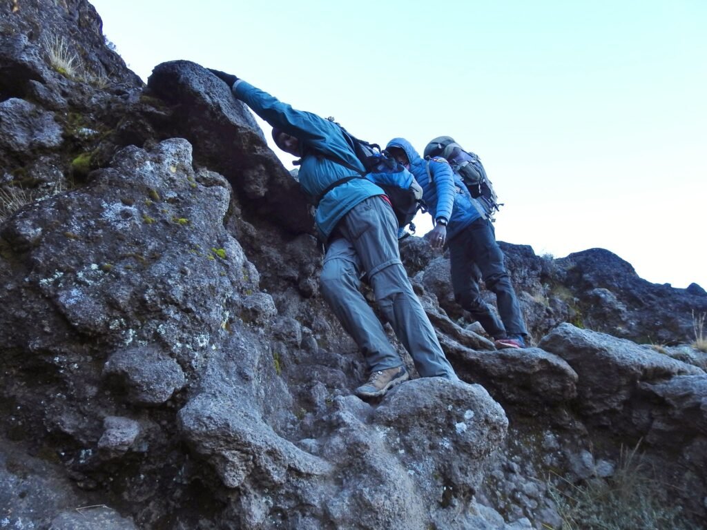
The first thing we had to do was conquer Barranco Wall.
We agreed to get an early start, so we were up at 6:00 am, and we were hiking by 7:10 am.
Barranco Wall is a steep cliff that is 257 meters (843 feet) high. It’s the first thing you have to climb when you leave Barranco Camp. It’s a part of the trail we call “monkey business” because you often will use all four limbs to get up it!
Kelvin (our photographer) wished had taken more pictures of this part of the trail but he was too busy using all four limbs to climb! It was probably their favorite part of the trip so far!
Ruth, heading up Barranco Wall.
No hiking poles for this part of the trip!
One of the reasons Kilimanjaro is popular is because it’s the only one of “the seven summits” that doesn’t require much in the way of technical climbing skills. It’s mostly a hike. A very steep, very long, and very difficult hike, but just about anybody can do it if they set their mind to it.
Looking down at a waterfall in Barranco Canyon.
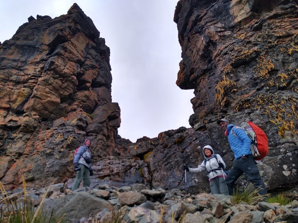
The Kissing Rock.
So-called because of how close you have to get your body and face to the rock as you pass this narrow section.

Kelvin kissing the rock! Hahaaa.,!
It’s hard to imagine, but remember that the porters also have to do this route, carrying all the stuff that they do. They are truly amazing! The heroes of the trek.
Ruth with Mt. Kilimanjaro.
Gorgeous scenery.
We got to a point where we could see Karanga Camp and it didn’t look very far away. But we had to go down and back up a valley in order to get to it.
Well, that added another hour or so to the hike!
Looking back at the valley we had to go through.
Clouds starting to move in.
Kelvin and Ruth… We made it to Karanga Camp just before 11:00 am.
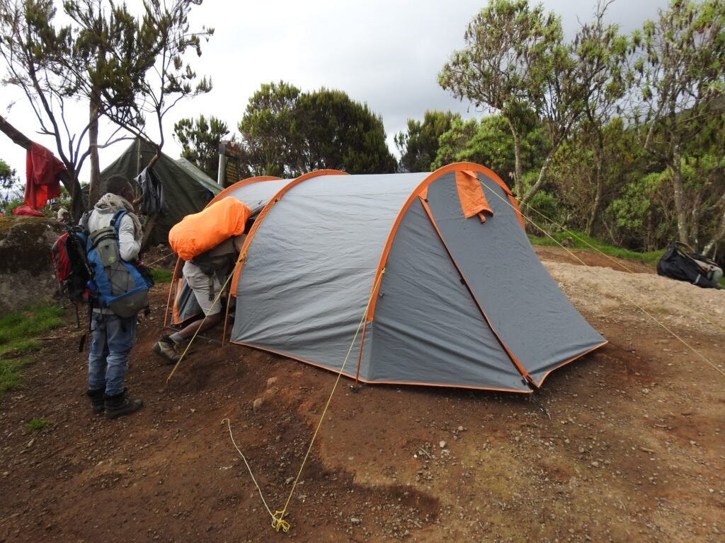
Our porters had already made it to Karanga Camp ahead of us, and because of the change in schedule and the long hiking day, they set up the tent and fed us a hot lunch!
Table set for lunch for Kelvin and Ruth.
Once again, they made a ton of food with fried chicken and chips and veggies and fruit for Kelvin and Ruth. And we get mad when we think you don’t eat enough, so they were stuffed. It’s good because we were also spending a lot of energy. And then we are confident that they’re good to go.
It was maybe 12:30 pm when we headed out again. By then, the clouds that had moved in had opened up and it was raining. So not many photos were taken by Kelvin on this section of the trail.
It was an uphill climb for about three hours. We made a pretty good time though and we were very pleased with Kelvin and Ruth.
It’s always like hiking on the moon.
Arriving at Barafu Camp.
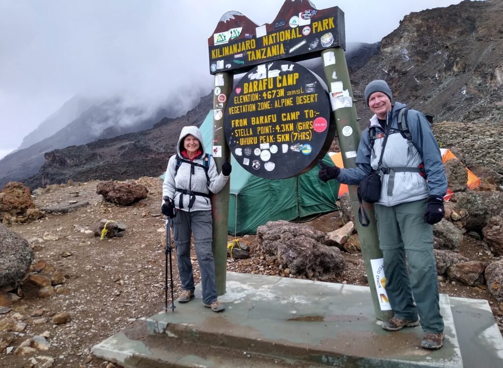
Barafu Camp is at 4,673 meters (15,330 feet) altitude and is the final camp before heading to the summit at 5,895 meters (19,350 feet).
The warning sign above is real. If people are going to have problems with altitude this is where it will begin to happen. As I’ve said before, it’s not a joke that people die on Kilimanjaro, and it usually has something to do with ignoring the signs of altitude sickness. It’s the main reason Kelvin and Ruth had to acclimatize by hiking Mt. Meru the previous week and drinking lots of water. We also did some regular tests on heart rate and blood oxygen levels every day.
At this altitude, the air is getting thin. At the summit, there is only 49% of the oxygen that is in the air at sea level. Just doing basic things that you don’t normally think about have you huffing and puffing.
Made it to Barafu Camp at 3:10 pm.
The guys already had our tents set up, with popcorn and hot ginger tea.
Now, let me tell you what was going to happen next!
We had just completed a fairly strenuous 8.5 km (5.3 miles) hike that gained about 724 meters (2,300 feet). We would now have an early supper and then go straight to bed. Try to sleep for about 5 hours and then get up at 11:30 pm in order to start hiking again at midnight. And this would be the toughest part of the whole trip. Normally we decide the time to go summit depending on the energy, pace, and physical well-being of a client… A six-hour uphill slog to do 4.5 km (2.8 miles) that gains another 1,219 meters (4,000 feet) during the summit attempt to 5,895 meters (19,350 feet).
Kilimanjaro Day 5 – Barafu Camp to the Uhuru Peak Summit 19,350′ altitude
We woke up at 11:30 pm and fed a hot drink of ginger tea to warm us up a bit for our planned six-hour hike in the darkness up to the summit of Mt. Kilimanjaro… Uhuru Peak is located at 5,895 meters (19,350 feet) altitude.
We normally pick a porter, the number depends on the number of clients and the general well-being of the client.
Why are we hiking in the dark? It’s a common question, and there are actually a few reasons.
Weather conditions at the top of Kilimanjaro are very changeable and difficult to accurately predict. Timing of the exquisite panoramic view display of the sunrise early in the morning, during the day, it could be anything from a clear blue sky to a blizzard! However, at night, things are generally clear and calm. Also, the Barafu Base Camp where most people leave from in order to get to the summit isn’t set up for long-term stays. There is no water supply there, and with a constant flow of new climbers, they don’t want you to overnight more than one night there. So when you come back down the mountain, you have to continue past Barafu Camp and normally on to Millenium Camp which is another 4 km (2.5 miles) down the mountain. With the climb up, it can take as long as 14 hours to complete and if you started at first daylight, you may not make it down the mountain before dark.
By 12:15 am, we had all of our winter summit gear on and our headlamps on, and we were on trail with our summit porter Fredy. Fredy had been to the top before, and it’s best to have more help if you run into trouble.
It’s very steep. The section to Stella Point climbs 1,079 meters (3,500 feet) in 3.3 km (2.0 miles). You can only inhale so much cold air before it starts to hurt, so you have no choice but to go slowly.
There were other groups on the trail as well. All moving at different paces, and you could see a stream of headlamps all the way up the mountain.
The hiking was tough. It was slow and monotonous. Not what we would call fun!
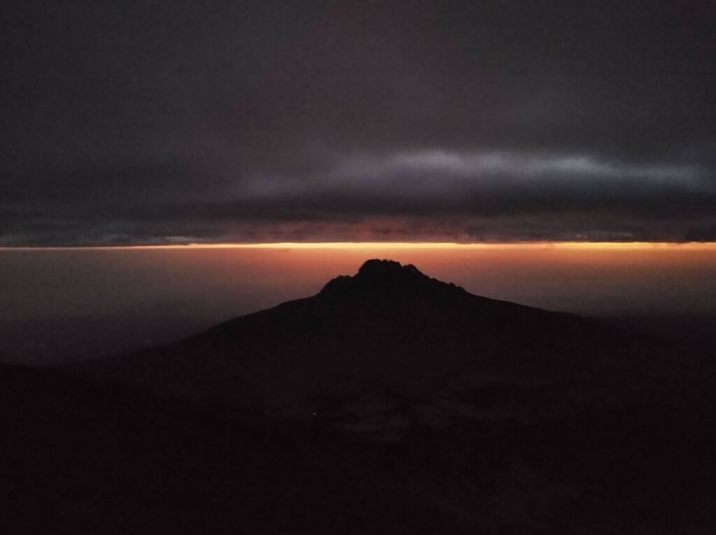
Mawenzi Peak at sunrise… 6:09am.
Mawenzi Peak at 6:45 am.
Mawenzi Peak is part of Mt. Kilimanjaro, but it is not often climbed and is off-limits due to the risk of falling rocks.
By this time, Kelvin and Ruth were starting to think they bite off more than we could chew. The difficulty became obvious to me when we began seeing the old person heading downhill past us. But these were not people who had already made it to the summit… these were people who couldn’t make it to the summit and had given up.
Their goal was Stella Point. Even though that’s not the summit, I told them that if you can make it to Stella Point, you can make it to Uhuru Peak.
The problem usually is, Stella Point never seems any closer. It was taking us an hour to do half a kilometer! I could see Ruth tiring. She was taking more and more breaks, and I could tell she was struggling. Kelvin was too, but I know Kelvin would have made it up faster.
Ruth and Kelvin had made an agreement. If either one of them couldn’t carry on, the other should continue to the top. At least one of them would make it.
Ruth stopped a couple of times and said she didn’t think she could go any further. I and Shalali continued to motivate her to get a few more steps out of her, but eventually, she just sat down and said that I should carry on without her. She was done.
I discussed with Sharali that the reason Ruth didn’t wanna go any further is that she thought she could not make it, but even more, she thought she could also become a reason for Kelvin’s failure. So we decided to separate them to boost Ruth’s spirit.
Shalali stayed with Ruth, and I carried on with Kelvin and Fredy (summit porter). At 7:20 am, we reached Stella Point.
From Stella Point, the trail evens out. It’s still another 1.2 km (3/4 mile) to the peak, but only another 140 meters (465 feet) altitude.
Kelvin thought it felt like winter in Canada! Kelvin and Fredy.
Me, Kelvin, and Fredy.
I think Kelvin’s smile is kinda forced! Hahaha…!
We made it to Uhuru Peak at 8:13 am. It wasn’t really much of a celebration because Ruth wasn’t there to share it with us. I knew that she was holding up with Sharali towards the summit, but it would be best if we were together.
Kelvin, at the summit of Mt. Kilimanjaro 5,895 meters (19,350 feet).
We left a note in the snow and headed back down.
The scenery at the top of Kilimanjaro.
We came around a corner, and what did we see??
Ruth and Shalali, still continuing our way!!
Shalali would simply not let her give up. She even broke down and cried at one point, but Shalali encouraged her some more… “I know you can do it” he would tell her.
She was so close. Kelvin and I wouldn’t let her give up either. So we went up to the summit again!
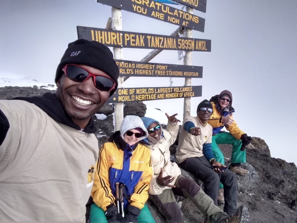
At 9:16 am, we made it together!
Kelvin thought, Thought that was the highest they will ever be without the help of an airplane! Group photo at the top!
Time to head back down.
Remember I said the weather changes quickly at the top?
Look at those clouds moving in.

Glacier at the top.
All of a sudden there was blue sky!
We still had a long day ahead of us. The plan was to make it down to Barafu Camp where our tent was still set up, have some lunch, then an hour nap, then do another 4 km (2.5 miles) down to Millenium Camp where we would spend the night. Then another 12 km (7.5 miles) downhill the next day to the Mweka exit gate.
So that’s what we did. No photos on the way down. Kelvin and Ruth thought they were in a bit of fog between the altitude and the exhaustion. Never did have any symptoms other than a minor headache though, which disappeared as we descended. They all were fine and never lost appetite. We heard quite a few stories from people who didn’t do so well. Some made it anyhow, and others didn’t.
We had lunch and then an hour’s nap. When we woke up, it was snowing (sleet?) at Barafu Camp.
It was snowing as we left Barafu Camp at 2:30 pm.
These are emergency stretchers that are used to transport sick or injured people down the mountain.
It was a tough, demanding, and monotonous day for the old couple. We made it to Millenium Camp at about 5:30 pm and we had dropped 2,076 meters (6,800 feet) since we had been at the top.
The guys already had our tent set up when it started pouring buckets of rain. It rained hard, and somehow drops of water started getting in Kelvin and Ruth’s tent when they told me, we immediately fixed it. Fortunately, it was our last night.
Kilimanjaro Day 6 – The final descent
We slept like a rock on our last night after the marathon of hiking we had done the day before. This night’s sleep is usually the best. Kelvin and Ruth, I think slept well… until one of the nearby camps started making noise at about 3:30 am.
We had wanted to get up early… but not that early! We still had an 11 km (6.8 miles) downhill hike to get to the exit gate where a van and a nice lunch would be waiting for Kelvin and Ruth. We woke up at about 6:00 Am.

We had overnighted at Millenium Camp and got a couple of photos of the sign at that camp… High Camp has been renamed “Millenium Camp”.
They haven’t changed the sign yet!
The heavy rain we had overnight would have been snow on the mountain, and it sure looks like there is some fresh snow up there.
Heading downhill.

It wasn’t long and we were back in the rainforest.
Love the thick green vegetation.
We made it to the Mweka Gate at 12:30 pm. Our trip was officially over, but we weren’t done spending time with the guys!
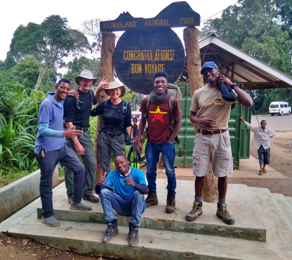
At the congratulatory sign.
What a great team…
Me, Kelvin, and Ruth.
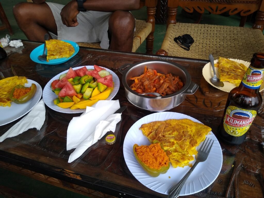
A van drove us around the corner to where our cook Martin had one final meal waiting for us. And an opportunity to drink a Kilimanjaro beer,!
Final lunch.
After lunch, Kelvin and Ruth offered to take the whole group out for beers. We ended up at a local bar in the town of Moshi where we sorted through our rental gear that had to be returned and chatted with the guys.

We were sitting outside when it began to rain. And rain. And rain harder. It poured buckets. We finally got into a waiting vehicle that would bring us back to Arusha. Kelvin got a few photos of the rivers that the rain had created.
What an adventure that was!
From the Machame entrance gate, we hiked 37 km (23 miles) up 4,068 meters (13,350 feet) to Uhuru Peak…. the top of Mt. Kilimanjaro… the Roof of Africa.
From the top, we then hiked another 20 km (12.5 miles) in altitude 4,244 meters (13,920 feet) down to the Mweka exit gate.
A total of 57 km (35.5 miles) in six days.

Kelvin and Ruth each received an official certificate!


More Pictures on my Instagram profile.
If you are planning for a trek to Kilimanjaro or Safari tour in Tanzania, contact me through the website or on my personal email.

What a glimpse of astonishment. To live is to travel and trek in the wilderness.
This is wonderful. Keep up the good work Bayona
Bro your the best 🙌 apart from being a mountain guide.. wewe ni good Author(Narrator)…Keep the energy alive bro❤
So pleased to see my colleague accomplishing great, keep it going👏👏
Amazing experience with Kobe and his team! Such a professional and fun guy to be around! We had an unforgettable experience and I’d highly recommend to anyone!
Keep up the good work Kobe🙌
Such a descriptive article,you surely love your job.It’s inspiring.
Appreciation to the passionate work u does bruv…..bug up sana👏🏼👏🏼👏🏼👏🏼✊🏾✊🏾✊🏾
We are the best bruh! let’s keep the good job alive. To Travel Is To Live
I’m very inspired by this